Deformability of soil


Liquefaction
Liquefaction is a phenomenon in which the strength and stiffness of a soil is reduced by earthquake shaking or other rapid loading. Liquefaction and related phenomena have been responsible for tremendous amounts of damage in historical earthquakes around the world.
Liquefaction occurs in saturated soils, that is, soils in which the space between individual particles is completely filled with water. This water exerts a pressure on the soil particles that influences how tightly the particles themselves are pressed together. Prior to an earthquake, the water pressure is relatively low. However, earthquake shaking can cause the water pressure to increase to the point where the soil particles can readily move with respect to each other.
Schematic behavior of sand grains in a soil deposit during liquefaction. The blue column represents the pore water pressure.
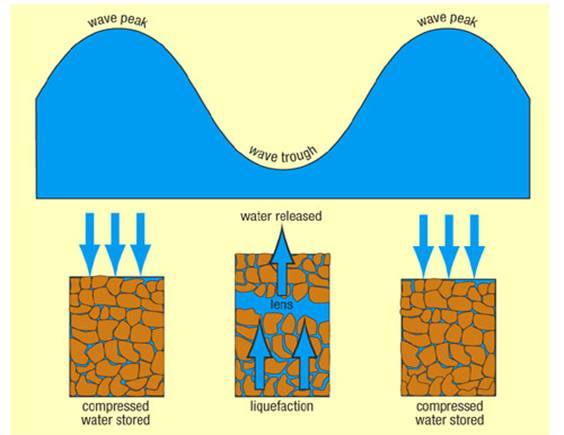
Earthquake shaking often triggers this increase in water pressure, but construction related activities such as blasting can also cause an increase in water pressure.
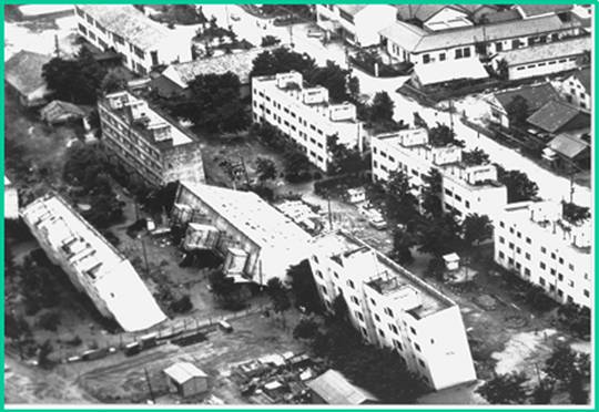
Overturned apartment complex, Niigata 1964

When liquefaction occurs, the strength of the soil decreases and, the ability of a soil deposit to support foundations for buildings and bridges is reduced as seen in the photo of the overturned apartment complex buildings in Niigata in 1964.
The type of ground failure shown above can be simulated in the laboratory,as seen in the video.
Liquefied soil also exerts higher pressure on retaining walls, which can cause them to tilt or slide. This movement can cause settlement of the retained soil and destruction of structures on the ground surface.
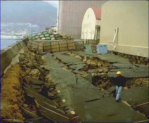
Lateral spread, Kobe earthquake 1995
Increased water pressure can also trigger landslides and cause the collapse of dams. Lower San Fernando dam suffered an underwater slide during the San Fernando earthquake, 1971. Fortunately, the dam barely avoided collapse, thereby preventing a potential disaster of flooding of the heavily populated areas below the dam.
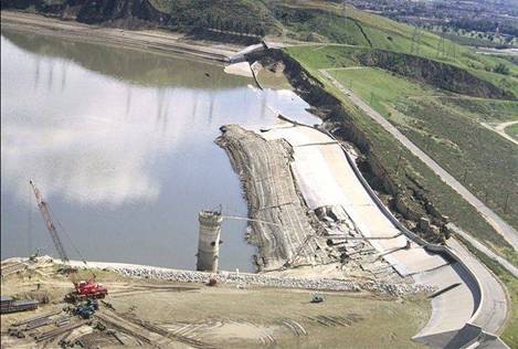
San Fernando, 1971